Map Panhandle Texas: Cities, Towns, Highways & Places to Visit
A good map panhandle texas is more than a picture of roads: it helps explain how the region’s cities, small towns, highways, canyons, lakes, and historic sites fit together. The Texas Panhandle occupies the state’s northwestern corner and is commonly defined as a 26-county region covering almost 26,000 square miles. Amarillo is the principal urban center, while communities such as Canyon, Borger, Pampa, Dumas, Dalhart, Hereford, Perryton, Canadian, and Stratford form important points across the area. (Panhandle Regional Planning Commission)
For travelers, the most useful way to read a map panhandle texas is by combining major highways with geographic landmarks. Interstate 40 crosses the southern portion, while I-27, US 87, US 287, US 60, US 54, and US 385 connect the region’s major communities. (Texas Department of Transportation)
Texas Panhandle Map: Major Cities and Towns
A map panhandle texas typically shows a wide network of communities rather than one concentrated metropolitan area. Distances between towns can be substantial, so choosing the right base matters.
| City or town | Where it fits on a Texas Panhandle map | Why travelers may use it |
|---|---|---|
| Amarillo | Central Panhandle | Main urban base, airport, Route 66 and attractions |
| Canyon | South of Amarillo | Gateway to Palo Duro Canyon |
| Borger | North of Amarillo | Access toward Lake Meredith and Hutchinson County |
| Pampa | North-central/eastern Panhandle | Regional services and access toward Canadian |
| Dumas | North of Amarillo | Useful base for the northern Panhandle |
| Dalhart | Far northwest | Important highway junction near New Mexico/Oklahoma |
| Hereford | Southwest of Amarillo | Agriculture and regional services |
| Perryton | Far northeast | Gateway toward the Oklahoma Panhandle |
| Canadian | Eastern Panhandle | Canadian River scenery and historic sites |
| Stratford | Far north | Near the Oklahoma border and US 287 |
TxDOT’s Amarillo District identifies communities including Amarillo, Borger, Canadian, Canyon, Dalhart, Dumas, Pampa, Perryton, Stratford, Hereford, Panhandle, Vega, and others as part of its regional transportation network. (Texas Department of Transportation)
Smaller places can also be worthwhile stops. Vega, Groom, Shamrock, Claude, Panhandle, Fritch, Quitaque, Silverton, Turkey, and McLean are particularly relevant to road trips because they connect historic routes, local museums, scenic areas, and regional highways.
Major Highways on a Map: Panhandle Texas
Understanding the road network is essential because the Texas Panhandle is a destination for drivers.
Interstate 40
I-40 is the major east-west interstate across the southern Panhandle. It connects Amarillo with communities such as Vega and Groom and continues east toward Oklahoma and west toward New Mexico. TxDOT identifies I-40 from the New Mexico state line to Wheeler County as a major priority corridor in the Amarillo District. (Texas Department of Transportation)
For Route 66 travellers, I-40 is especially important because many historic Route 66 locations are now linked to the interstate corridor.
Interstate 27
I-27 runs north-south through Amarillo and toward the southern Panhandle. TxDOT identifies I-27 as part of the Ports-to-Plains Corridor. A current feasibility study is evaluating a potential upgrade of US 87/US 287 between Amarillo and Dumas to interstate standards, so travellers should distinguish today’s signed highways from proposed future improvements. (Texas Department of Transportation)
US 287
US 287 is one of the region’s most important north-south routes. It links Amarillo with Dumas and continues toward Dalhart and the Oklahoma Panhandle. It also provides access to Lake Meredith and the Alibates area north of Amarillo. (National Park Service)
US 60, US 54, US 87 and US 385
These routes provide additional east-west and north-south connections across the region. US 60 serves communities including Amarillo, Pampa, and Canadian; US 54 is important around Dalhart; US 87 connects Amarillo with northern communities; and US 385 serves the western side of the Panhandle. TxDOT lists these corridors among the major highways in the Amarillo District. (Texas Department of Transportation)
Best Places to Visit on a Map Panhandle Texas
The main reason to study a map of the Texas Panhandle is to understand how far apart the region’s major attractions are.
For more insights, read our previous article: Charleston SC to Savannah GA.
Palo Duro Canyon State Park
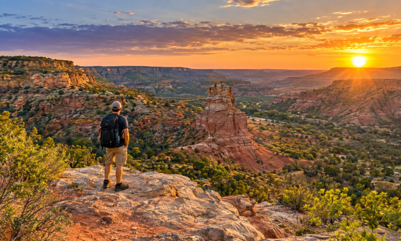
Palo Duro Canyon is one of the Texas Panhandle’s defining landmarks. Texas Parks and Wildlife describes it as the second-largest canyon system in the United States, extending roughly 120 miles and reaching depths of up to 800 feet. The state park lies about 12 miles east of Canyon and is accessible from Amarillo via I-27 and State Highway 217. (Texas Parks & Wildlife Department)
The park offers more than 30 miles of hiking, biking, and equestrian trails. The Lighthouse formation is one of its best-known landmarks, while the canyon floor provides a dramatically different landscape from the surrounding High Plains. (Texas Parks & Wildlife Department)
Because Palo Duro is south of Amarillo, it fits naturally into a Canyon-Amarillo section of a map panhandle Texas road trip.
Caprock Canyons State Park
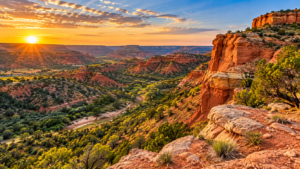
Caprock Canyons lies farther southeast near Quitaque and offers a different canyon experience. The park is known for red-rock formations, the Texas State Bison Herd, Lake Theo, hiking, biking, horseback riding, and camping. Texas Parks and Wildlife reports nearly 90 miles of trails across the park and trailway system. (Texas Parks & Wildlife Department)
The Caprock Canyons Trailway extends across Floyd, Briscoe, and Hall counties and follows a converted railroad route through 46 bridges and Clarity Tunnel. (Texas Parks & Wildlife Department)
On a map of the Texas Panhandle, Caprock Canyon is best understood as a southeastern Panhandle destination rather than a quick stop just outside Amarillo.
Lake Meredith National Recreation Area
North of Amarillo, Lake Meredith occupies the Canadian River valley. The reservoir was created by impounding the Canadian River and provides opportunities for fishing, boating, hiking, camping, picnicking, and wildlife watching. (National Park Service)
Lake Meredith is particularly useful for travellers who want water-based recreation in a region better known for plains and canyon scenery.
Alibates Flint Quarries National Monument
Adjacent to Lake Meredith, Alibates Flint Quarries preserves a remarkable archaeological landscape. The National Park Service says people harvested Alibates flint in the area for more than 13,000 years, and the monument contains hundreds of prehistoric quarry pits. (National Park Service)
The monument lies north of Amarillo and south of Fritch along US 287, making Lake Meredith and Alibates logical companions on a same-day or multi-day itinerary. (National Park Service)
Amarillo and Route 66
Amarillo is the most convenient urban starting point for many visitors. Its Route 66 attractions include the Historic Route 66 District, Cadillac Ranch, and other roadside landmarks. The Amarillo Convention & Visitor Council identifies the city’s historic Route 66 district along Sixth Avenue and highlights Cadillac Ranch west of the city. (Visit Amarillo)
A map panhandle texas road trip focused on Route 66 can continue east toward Shamrock, where the historic Tower Station and U-Drop Inn are major Route 66 landmarks, or west toward Vega and the New Mexico border. (Visit Amarillo)
Panhandle-Plains Historical Museum
In Canyon, the Panhandle-Plains Historical Museum provides context for the landscape surrounding Palo Duro Canyon and the wider region. Its collections cover archaeology, geology, palaeontology, art, ranching, transportation, petroleum, and the history of people living on the Plains. (Panhandle-Plains Historical Museum)
One important current detail: the museum’s official website states that its physical doors are temporarily closed while major building improvements and safety issues are addressed. Travellers should check the museum’s official site before planning a visit rather than relying on older opening-hour information. (Panhandle-Plains Historical Museum)
How to Travel Around the Texas Panhandle
A map panhandle texas is most useful when paired with a rental car or private vehicle. The region is geographically spread out, and major attractions are separated by open highways rather than a dense public-transport network.
Amarillo is the main air gateway. Rick Husband Amarillo International Airport is about six miles east of downtown Amarillo and currently has commercial service from American, Southwest, and United. The airport lists destinations including Dallas, Denver, Houston, Las Vegas, and Austin, although airline schedules can change. (Fly AMA)
For travellers arriving by road, I-40 is the obvious east-west corridor. US 287, US 87, US 60, US 54, US 385, and I-27 provide the major connections between the region’s communities. (Texas Department of Transportation)
Plan fuel stops in advance when exploring remote areas. Cell service, food options, and services become less predictable outside larger towns.
How Many Days Do You Need in the Texas Panhandle?
Two to three days work well for a first trip centred on Amarillo, Palo Duro Canyon, and Route 66.
A simple itinerary could look like this:
- Day 1: Amarillo, Historic Route 66 District, Cadillac Ranch and other city attractions.
- Day 2: Canyon and Palo Duro Canyon State Park.
- Day 3: Choose Lake Meredith and Alibates Flint Quarries, or drive farther south toward Caprock Canyon.
A longer four- or five-day road trip gives you more time for smaller towns, museums, hiking, wildlife, and Route 66 stops.
The best itinerary depends heavily on which side of the map you want to explore. Trying to cover the entire 26-county area in a weekend would mean spending much of the trip behind the wheel.
Best Time to Visit the Texas Panhandle
Spring and fall are often comfortable seasons for combining outdoor activities with road trips, while summer can bring significant heat.
Palo Duro Canyon reports an average July high of about 92°F, and Texas Parks and Wildlife warns that excessive heat can lead to trail closures. Caprock Canyon can experience even higher summer temperatures. (Texas Parks & Wildlife Department)
Winter can be quieter, but travellers should remember that the Panhandle faces rapidly changing weather, including strong winds, cold temperatures, snow, and icy road conditions.
Before setting out, check the weather and road conditions for the specific part of the region shown on your map panhandle texas, especially when travelling through remote areas.
Tips for Using a Texas Panhandle Map
A few planning habits make a major difference:
- Mark your overnight base before choosing daily attractions.
- Group attractions by geographic area instead of zigzagging across the Panhandle.
- Keep an offline map available for rural areas.
- Check state-park alerts before leaving, particularly after heavy rain or during extreme heat.
- Reserve popular state-park day-use or camping access when required.
- Allow extra time for photographs, wildlife viewing, and small-town stops.
- Treat distances as a planning issue: a destination that looks close on a statewide map can still require substantial driving.
For Palo Duro Canyon, Texas Parks and Wildlife specifically recommends reservations because the park can reach capacity. Trail conditions can also change after wet weather or during excessive heat. (Texas Parks & Wildlife Department)
Conclusion
The Texas Panhandle is easiest to understand when you view roads and geography together. Amarillo forms the main urban hub, while Canyon, Dumas, Dalhart, Borger, Pampa, Perryton, Canadian, and smaller communities spread outward across a large High Plains landscape. A useful map of the Panhandle should show both the highway network and the natural landmarks that shape the region, particularly Palo Duro Canyon, Caprock Canyon, Lake Meredith, and the Canadian River breaks.
For a first visit, concentrate on a manageable section rather than trying to cross the entire Panhandle. Use official highway and park maps, check conditions before driving, and group attractions geographically. That approach turns a very large region into a practical road-trip itinerary.
Frequently Asked Questions
What is the Texas Panhandle?
The Texas Panhandle is the northwestern portion of Texas and is commonly defined as a 26-county region. It sits directly south of the Oklahoma Panhandle and includes Amarillo and many smaller High Plains communities. (Panhandle Regional Planning Commission)
What cities are on a map panhandle texas?
Major communities include Amarillo, Canyon, Borger, Pampa, Dumas, Dalhart, Hereford, Perryton, Canadian, and Stratford. Numerous smaller towns are also spread throughout the 26-county region.
What is the most important highway in the Texas Panhandle?
Interstate 40 is the region’s major east-west interstate, while I-27, US 287, US 87, US 60, US 54, and US 385 provide important regional connections. (Texas Department of Transportation)
What are the main places to visit in the Texas Panhandle?
Major attractions include Palo Duro Canyon State Park, Caprock Canyon State Park, Lake Meredith National Recreation Area, Alibates Flint Quarries National Monument, Amarillo’s Route 66 attractions, and the Panhandle-Plains Historical Museum.
Is Amarillo a good base for exploring the Panhandle?
Amarillo is a practical base for many first-time visitors because it has the region’s major commercial airport, extensive road connections, city attractions, and relatively convenient access to Palo Duro Canyon and northern Panhandle destinations. (Fly AMA)
Where can I find a detailed map panhandle texas?
For trip planning, use official TxDOT highway maps for roads and Texas Parks and Wildlife maps for state parks. National Park Service maps are particularly useful for Lake Meredith and Alibates Flint Quarries. Official park maps are preferable to relying only on generalised online maps. (TxDOT FTP)